SITE NEWS .. SITE NEWS .. SITE NEWS
2025: SPREADSHEET: Roman Army Campaigning - (in LibreOffice .ods format). UPDATED Aug 2025. Improvements and bug fixes. 2017 description in Archaeology Introduction.
2024: PAPER: Research on the effects of relative sea-level change on the river Exe estuary in the mid-1st century AD (South-West Britain). Limes Congress XXV.
2023: SPREADSHEET: Roman Army Campaigning - spreadsheet (xlsx). UPDATED May 2023 with dynamic charts of marching camp defence profiles and camp plans. Description in Archaeology Introduction.
2022: PAPER: Research on the effects of relative sea-level change on the River Exe estuary in the mid-1st century: implications for the location of Roman sea-port and barge-quay facilities serving the Neronian fortress of Legio II Augusta at Exeter. Roman Frontier Archaeology (Archaeopress 2022): 187�200.
2022: POSTER: Research on the effects of Relative Sea-Level change on the River Exe estuary in the mid-1st century AD (South-West Britain)..
2019: Observations on the Roman road between Exeter, North Tawton and Okehampton.
2017: Early Imperial Roman army campaigning: observations on marching metrics, energy expenditure and the building of marching camps.
February 2015: Finding the site of Boudica's last battle: multi-attribute analysis of sites identified by template matching. (Internet Explorer users click here)
2015: Kaye, S.J. 2015. The Roman invasion of Britain, 43 AD: riverine, wading and tidal studies place limits on the possible locations of the two-day river battle and beachhead. Archaeologia Cantiana, Vol. 136, 227-240.
March 2014: The Roman invasion of Britain, 43 AD: riverine, wading and tidal studies as a means of limiting the possible locations of the invasion-ground and the two-day river battle.
October 2013: New essay on Roman legionary march velocities, energy expenditure, column formations and the building of temporary marching camps.
June 2013: Conference Poster: Searching for Boudica's last battle: an approach via terrain analysis, hydrology and marching camps. Conference 'On Boudica's Trail', Atherstone Civic Soc. at Warwick Uni.
March 2013: The essays on searching for the site of Boudica's last battle have been updated, and a new work covering Roman marching camps added.
May 2012: new section on Archaeology and the author's work on the search for Boudica's last battle in the UK.
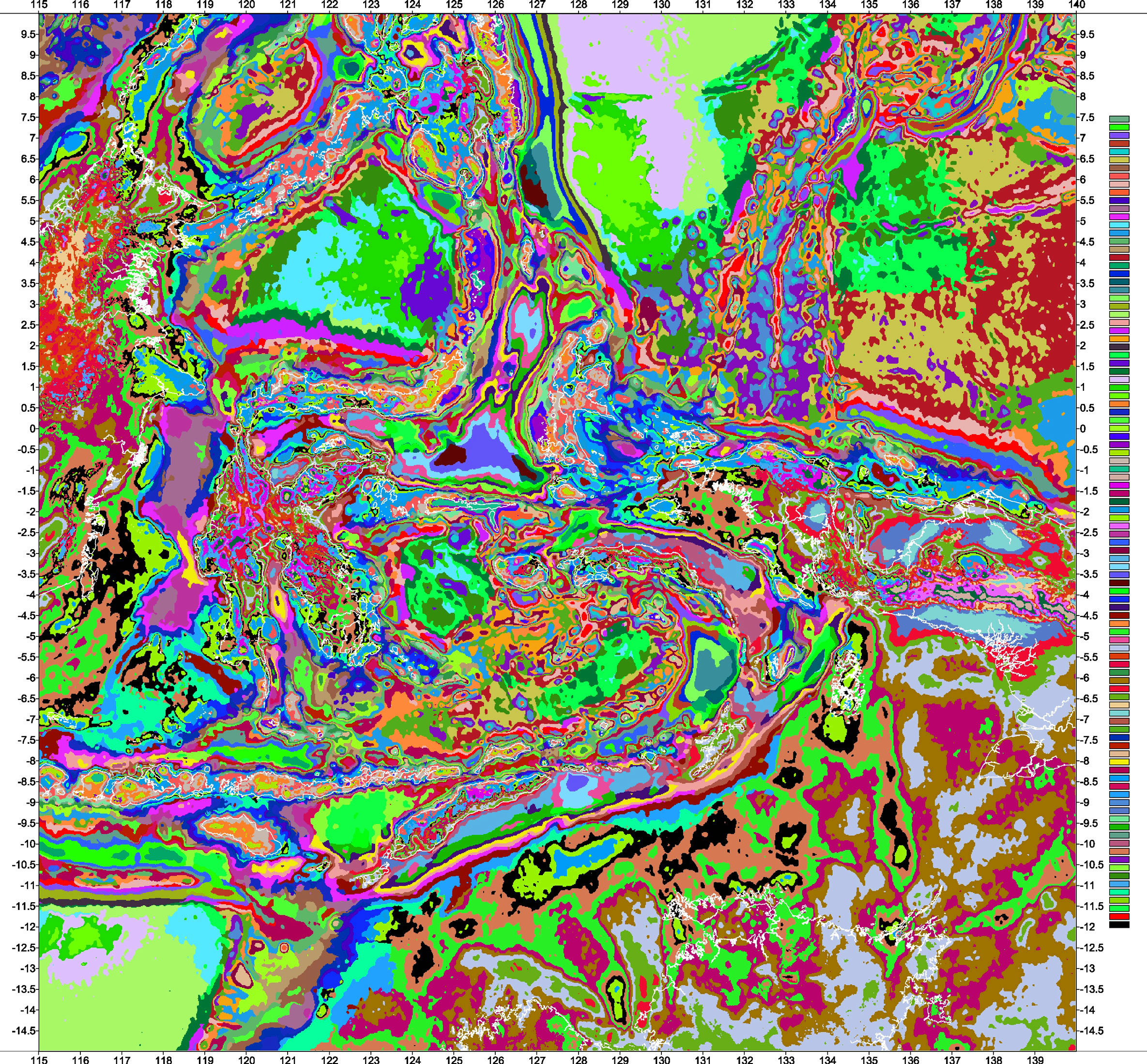
September 2011: new section added on the classification of gravity data for the Eastern Indonesia region. See the Gravity Classification section below, the menu left or click here.
April 2011: The site has been redesigned, marine satellite gravity and topographic data updated and old on-shore gravity data for Timor, Tanimbar and Kai islands re-corrected. In summary, all gravity maps are new and now extend from 10N to 15S.
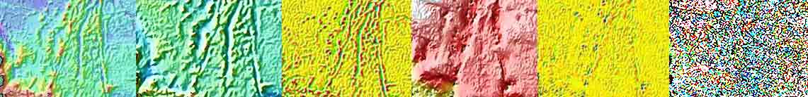
The image above (click to open an image for Eastern Indonesia, 3.7mb) is the result of unsupervised classification of principal component analysis of the area centred on the Banda ridges. A description of this statistical process, together with more detailed imagery, is available in the Gravity Classification section.
Site Overview - Geophysics
For an introduction to the archaeology work please go here.
This is the fourth version of a web site primarily dedicated to the investigation of the geophysical and geological attributes of Eastern Indonesia and surrounding areas. However, interests change and the author has written a number of archaeological essays on work designed to search for the site of Boudica's last battle.
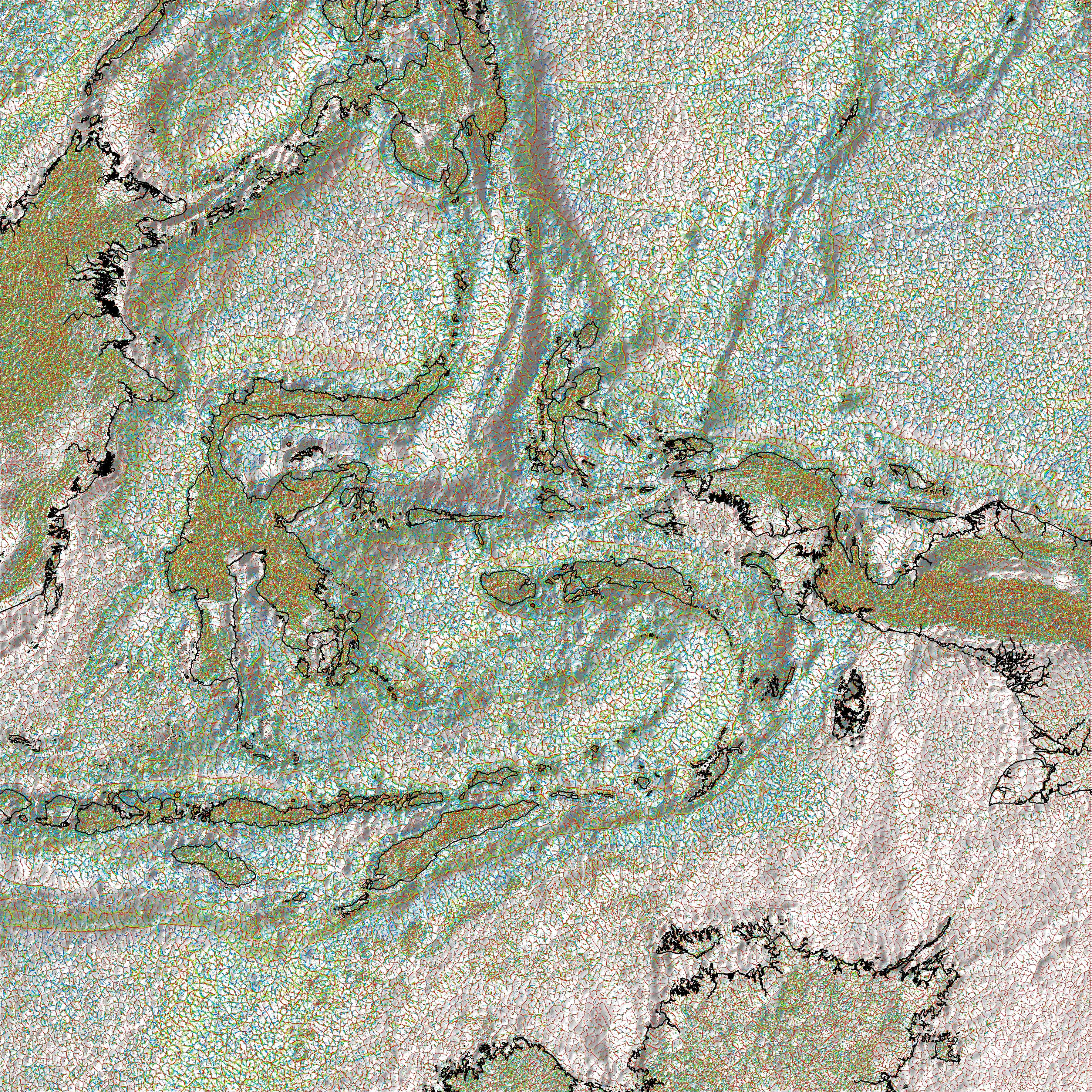
Here you will find topographic maps, Bouguer and Free-air gravity anomaly data and maps, together with their residuals. Work has also been conducted to produce gravity lineament and classification maps. Areas covered include: Timor, Seram, Kai Islands, Tanimbar Islands, Aru, Buru, Buton, Irian Jaya, Papua, Sulawesi, Flores, Kalimantan, Borneo, Mindanao, Philippines, Sumatra, Nias, Java, Palawan, Palau, Yap, Celebes Sea, Halmahera, Pegun, Caroline Sea, Makassar Straits, Sumbawa, Sumba, Bonaparte Basin, Scott Plateau, Arafura Sea, Mollucca Sea, Banda Sea and many more thoughout Indonesia.
The geology of Eastern Indonesia is dominated by the presence of the Banda Arcs, geological and geophysical features distinguished by the presence of arcuate island groups. These arcs are typically made of volcanic and continental rocks, of mixed and poorly-understood provenance, are usually marked by small islands and are either located within or flank the Banda Sea. The flanking continental arc extends clockwise from Seram (Ceram) in the north, southwards through the Kai and Tanimbar Islands and the island of Timor. This is a very simple description of a very complex geological region.
One of the primary aims of the site is to combine the author's earlier (late 1980s-1990) work on the gravity of the islands of Timor, Tanimbar and Kai with the very latest satellite-derived gravity and topographic data sets to produce images and maps. Please review the Data Sources page for a description of data age, provenance and distribution and the opportunity to download data for Timor, Tanimbar and Kai.
The gravity data displayed, marine satellite and on-shore for the Timor, Tanimbar and Kai island groups, have been re-computed to the latest standards and conventions. Viewers are advised to read the Data Processing page to understand the steps taken, reduction parameters applied and errors remaining in the data but, in summary, the complete Bouguer anomalies displayed have been terrain corrected and are referenced to the International Terrestrial Reference Frame (ITRF) ellipsoid height (GRS80).
A web site is an imperfect tool for the display of high-definition images and maps, with all being displayed at a lower resolution than the originals. Also, the study area of Eastern Indonesia ranges from 115E to 140E and 10.0N to -15S; a very large area. The combined consequence is that many maps (jpegs) are large - apologies to the many viewers on low-bandwidth connections.
Finally, higher resolution maps and images may be made available to interested parties - write to the author via the Contact Author button on the left.
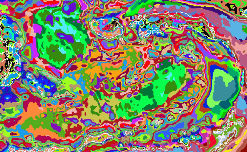
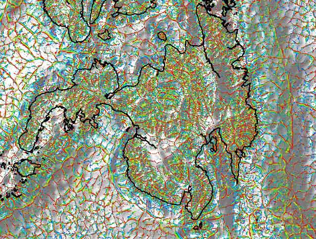
Gravity lineaments around Mindanao, Philippines
 Click to open in a new tab a large (3.5mb) image of the whole of Eastern Indonesia.
The image above is an example of the use of gravity lineaments to show various geological structures on and around the island of Mindanao. Use the menu on the left to see similar images for Eastern and Western Indonesia.